
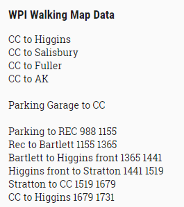
When I got to campus I parked in the parking garage and began collecting data by recording my step count on the Fitbit. I started walking towards the campus center making sure to stop at the entrance of each of the buildings on my way directly in front of the door to record the step count at that point.
However, due to the cold and the snow, Ryan was hesitant about having to count steps and thought it might be faster to use a GPS app to just calculate distance walked, such as a fitness app that measures your run distances. We weren’t sure which would be easier, counting steps using a Fitbit, which might give more directly relevant results, or distance, which could be more broadly applied.
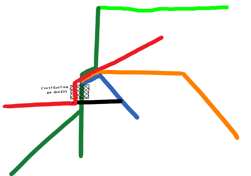
During our outline process, we decided where we would generally have lines placed, showing the areas and paths that we felt were most commonly walked along. We kept refining our line placement and divided the places where we would walk.
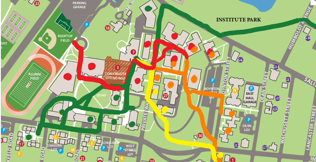
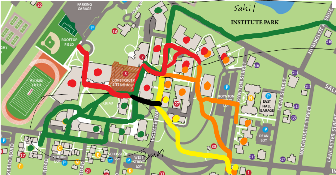
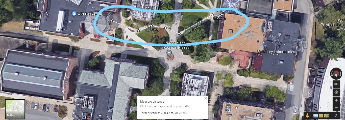
However, as we were figuring out which places to walk to and in which order, it dawned upon me to just use Google Maps. I remembered that it had a tool to measure distance between two points, and in fact we found out that you can trace a path and it will calculate the distance along it. As a result, we ended up just using that for the maps.
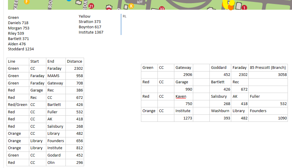
We inputted all of the data into an Excel spreadsheet and annotated our outline with the specific data that we wanted to include.
All that’s left to do is take the data and the outlines and make them polished.